Baldwin County, Ga.
Maps
|
Plat
Map District No. 1, 1804
|
Plat District No. 2, 1805
|
|
Plat
Maps District 7-15, 1807
|
Plat
Map, District No. 7, 1808
|
|
Historical
Baldwin County Maps
|
Militia District
Map
|
|
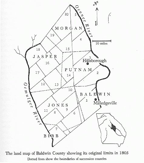
1805 Baldwin County
Map
|
1807
Baldwin County Map
|
|
Plat
Map, District No. 17, 1827
|
Map of Milledgeville
1830
|
Map of Milledgeville
1830
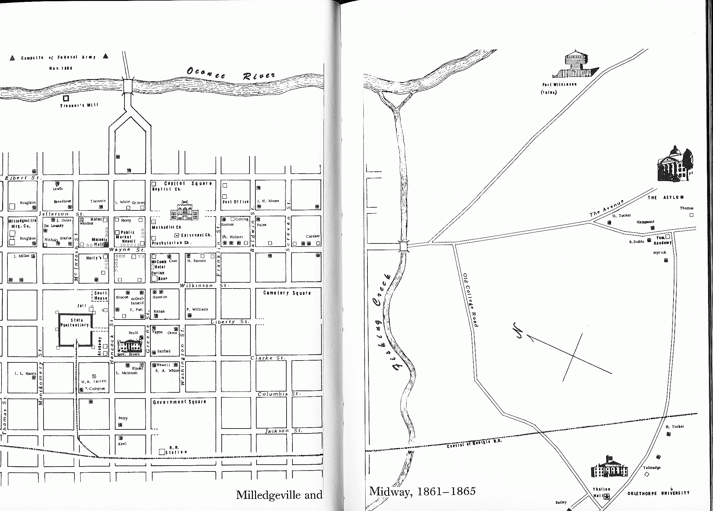
Map
of Milledgeville and Midway 1861-1865
|
Plat
Map District 3-6, 1866
Plat
Map District 18-20, 1866
|
|
1867
Baldwin County Map
|
1869
Baldwin County Map
|
|
1884
Sanborn Fire Insurance Maps - Milledgeville
|
1889
Sanborn Fire Insurance Maps - Milledgeville
|
|
1895
Sanborn Fire Insurance Maps - Milledgeville
|
Halls
1895 Ga Map (land districts)
|
|
1901
Sanborn Fire Insurance Maps - Milledgeville
|
1901
Sanborn Fire Insur. Maps -Stevens Pottery
|
|
1908
Sanborn Fire Insur. Maps -Stevens Pottery
|
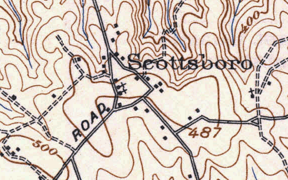
Scottsboro,
The Colony 1909
|
|
Map
of Milledgeville 1909
|
Carling Station,
Midway, State Sanitarium 1909
|
|
1913
Sanborn Fire Insur. Map - Stevens Pottery
|
1913
Sanborn Fire Insurance Maps - Milledgeville
|
|
1913
Milledgeville and some portions of Baldwin Co
|
**
|